Proliferated Drones

A Perspective on Indonesia

By Dr. Connie Rahakundini and Lt. Col. Ade Prasetia, S.Kel, M.si (Han)

Introduction

The development of drones in Indonesia first started in 1994 during a reunion of Institute of Bandung flight engineer graduates who had a vision to build an unmanned aerial vehicle (UAV) indigenously. The plan subsequently led to the formation of the PT Uavindo Co., which developed its first UAV, Sky-Spy-5, in 2003. The military immediately utilized this drone for intelligence purposes. New interest in UAV technology was sparked when the government passed legislation for the self-reliance of the national military industry. In addition, a national telecast of the presidential debate in 2014 sparked even more interest when one candidate, Joko Widodo, who later became the president of Indonesia, strongly expressed his commitment to employ drones in monitoring Indonesia’s borders and maritime zones.

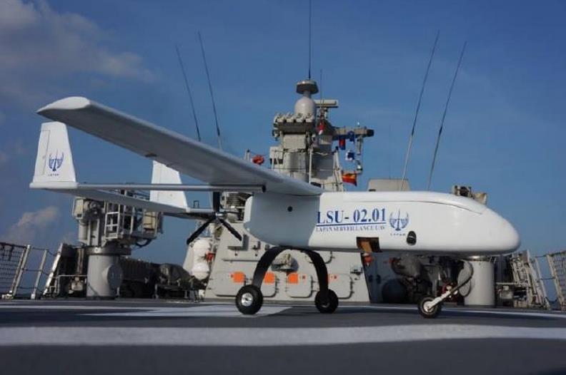
Since then, Indonesia has managed to indigenously develop around 14 drones. However, by the end of July 2015 the Department of Defense (DoD) had finalized new contracts with four Indonesian companies to develop another eight drones that utilize domestic and European Union (EU) drone technology for defense purposes, especially for the army and navy. These first eight military drones are part of a total of 80 drones that are to be procured by the Indonesian DoD by 2017. This will be followed by second and third military drone development projects that are scheduled for completion in 2019.

Currently, there are many parties involved in drone development, with research and development (R&D) conducted by ministerial institutions as well as by nonministerial government institutions, universities, private institutions, individuals, and the military. All of these UAVs were developed for civilian surveillance purposes. However, recent experiments and flight tests have demonstrated that there is little to no technical barrier to developing UAVs for military purposes such as carrying light weapons or bombs.

Technology

The technology used by indigenous Indonesian drones is still in the prototype phase; however, the country operates a number of foreign-made drones. For example, the Indonesian military operates the Israeli Heron II.1 This drone’s speed is twice that of the fastest locally developed drones, with flying duration three times longer and cruise altitude four times higher than indigenous drones. Indonesia has a number of other moderately capable drones in its inventory. For example, the largest wingspan in the Indonesian inventory is 6.9 meters (Crow and Woodpeckers), while the largest maximum takeoff weight is about 120 kilograms (Crow, Woodpeckers, and Wulung)2 and the largest payload about 20 kilograms (Cleaver and SmartEagle II). In terms of speed, the fastest drones only have the capability of reaching the speed of 81 knots (Cleaver) and the longest flying duration is only eight hours (Army ASD). Similarly, the maximum range of domestic UAVs is only 400 kilometers (LSU), with a maximum altitude of approximately 2,400 meters (Crow and Woodpecker). Moreover, UAVs developed by Badan Pengkajian dan Penerapan Teknologi (BPPT), or Agency for the Assessment and Application of Technology, still employ two-stroke engines, which are quite noisy, with the base material made out of carbon fiber that is still detectable by radar.

There are plans to combine the technology of military UAVs with a base transceiver system (BTS), developed by researchers from Surya University. Meanwhile, Puna, a product of BPPT, still uses engines and machinery from Germany and cameras from Taiwan. Recently, plans called for Wulung drones to be mass-produced, and a drone, OS-Wifanusa, was developed to operate in Indonesia’s border areas.3

There is a cooperation plan between BPPT and Japan that will involve the use of a high-technology camera from Japan for a geographical mapping project. Based on previous experiences, cooperation between BPPT and Japanese institutions always involves a scholarship or training program in Japan as a form of technology transfer. BPPT uses technology transfer in return for cooperation as a strategy to gain knowledge of foreign technologies. This will further encourage the development of UAVs with indigenously made components. Currently, civilian UAVs still contain imported components in their engines, machinery, and cameras.

Strategic Implications

The development of drones in Indonesia immediately raises various application possibilities. To date, drones have only been employed for surveillance tasks, including those related to traffic control, disaster response (especially floods), mountain rescue, and border control. Potential applications for extinguishing forest fires, seeding clouds, or mapping and monitoring high-voltage power lines have also been considered.

The government commitment to the use of drone technology has been expressed in the Ministry of Transportation Regulation No. PM 90/2015 on the Control of Unmanned Aircraft Operations Airspace Served in Indonesia. This regulation states that drones can be used for the benefit of the government in the form of state border patrols, maritime patrols, weather observation, observation of plant and animal activity in national parks, and geographical surveying and mapping.4

Militarily, the use of drones will soon be maximized. In 2015, the Ministry of Defense planned and financed new drone projects for military purposes that are broader than just the interests of intelligence, to include electronic warfare and the delivery of weapons. The main purpose of this initiative is to mimic the use of UAVs in Iraq as kamikaze weapons5 or as countermeasures. As expressed by Widodo in a campaign speech, the main target for this initiative is foreign vessels that are operating illegally in Indonesian territory, engaging in activities that range from illegal fishing to transnational crimes and illegal trafficking over Indonesian waters and land borders.

Examples of this initiative are expressed in the Ministry of Transportation Regulation No. 90/2015, which prohibits drones from flying above 150 meters. Only drones that serve the interest of the government may fly above 150 meters, and this requires permission from the Directorate General of Civil Aviation. Drones are also banned from operating within 500 meters of restricted airspace. Furthermore, camera-equipped drones must also obtain permission from the authorities in the region to be monitored.

stealth-drones-imageThis regulation would be violated if a foreign drone attempted to enter Indonesian airspace, under the control of either another government or a non-state actor. The most likely response to such a violation would be to provide a visual warning. If the warning was not heeded, the military could take steps to shoot down or take control of the system if possible. Of course, the problem would be more complicated if the drone was armed.

As in the case of the entry of the U.S. fleet into the Java Sea, as an example of a foreign military entering the Indonesian region without permission, Indonesia would send a protest note to the concerned government.6 Indonesia would use diplomatic warnings and provide evidence to use the intrusion as a bargaining tool in supporting the interests of national defense. This method was employed in the case of the detection of an American spy ship in Eastern Indonesia during the President Sukarno era.7

The first regulation issued by the government in relation to drones was just released on May 12, 2015. This regulation is still from the minister of transportation and has no clear sanctions for violators.

Constraints

While there are few technical limitations on the development of military drones in Indonesia, there are substantial financial limitations. The funds required for the research and development of unmanned combat squadrons renders these systems quite expensive. Therefore, for the time being, it is not yet feasible for Indonesia to use UAVs for real military purposes. The political will needed to advance indigenous drone production is similarly limited.

The development of drones in Indonesia is still constrained by a lack of funds, and stronger political will is also needed. Such development should be translated immediately into a military strategy and doctrine that can be used as the foundation to create a national UAV defense industry.

Conclusion

Indonesia still has room for substantial improvement in developing locally made drones relative to those produced by Israel and other countries. However, the interest in developing drones for military purposes is quite strong, particularly in order to counter the possibility of intrusion from foreign powers into the country.

As a strategic industry, the development of drones for defense purposes should be immediately integrated. For example, the government could create a government special body to direct research and development investments and to serve as a manufacturer of UAVs for defense purposes. To realize this initiative, the Indonesian government could acquire shares of companies that are already involved in the development of UAVs, such as GTSI, Uavindo, or ATI. This government special body could then be transformed into a state-owned company, following the footsteps of other similar institutions as part of self-reliance national defense strategy.

In essence, as the United States, European Union countries, and China have continued the development and use of drones for military and non-military purposes, so too must Indonesia. In the future, the key aspect in preventing the misuse of drone technology (by non-military parties) will be the involvement of the government, especially DoD, in developing appropriate airspace laws and regulations.

Response: Australia Perspective

 Dr. Carlyle A. Thayer

Connie Rahakundini Bakrie and Ade Prasetia’s assessment of Indonesia’s capacity to produce and operate drones offers a frank overview of the obstacles and limitations of deploying indigenously manufactured drones. Indonesia currently possesses 14 drones to carry out civilian missions and is producing another 8 for defense purposes. Indonesia’s drones are limited by technology, small payloads, short ranges, and limited time for patrol. Indonesia plans to have 80 military drones operational by 2017.

This should not raise undue security concerns in Australia. Indonesia’s civilian drones will be employed for mapping and geographical survey, traffic control, weather data collection, national park observation, disaster response, mountain rescue, and border control, while its military drones will be used to monitor Indonesia’s borders and maritime zones.

Indonesia’s development of drones for both civil and defense purposes creates the opportunity for further collaboration with Australia’s police and defense forces. During the past year, bilateral relations have been on the uptick. The Australian Federal Police and Indonesia’s National Police reached a new agreement this year to cooperate against terrorism and transnational crime. There is thus scope for further cooperation in surveillance technology and intelligence sharing.

This year, Indonesia and the Australian Border Force have additionally set up a combined maritime security program at their joint Jakarta Center for Law Enforcement Cooperation in Semarang, Indonesia. Australia’s Border Force and Indonesia’s Bakamla (coast guard) established a maritime policing partnership to combat transnational crime (illegal fishing, drug shipments, smuggling, piracy, and terrorism). The partnership covers training, criminal intelligence exchanges, and joint patrols (but not joint operations against people smugglers). Indonesia’s employment of military drones to enhance its maritime surveillance capacity, coupled with intelligence exchanges, will enhance both parties’ maritime domain awareness in critical areas.

The Indonesian assessment reveals that the country is considering arming its drones with light weapons or bombs. But given the constraints of cost, technology, and operational capabilities, the prospect of armed Indonesian drones does not represent an immediate threat to Australian security. Nonetheless, Australian defense intelligence will undoubtedly monitor these developments closely.

Indonesia’s plans to develop drones for military missions offer more opportunities for security collaboration than they do challenges to Australia’s security. Australia is mulling plans to acquire six or more Triton drones for maritime domain awareness by 2020, just after Indonesia’s military drones enter service around 2017. In sum, the introduction of drones for maritime surveillance – coupled with ongoing intelligence exchanges – will enhance the security of both countries.

Dr. Connie Rahakundini Bakrie is a visiting lecturer at SESKOAU (Air Force Command College) and SESKOAL (Navy Command College) in Indonesia. She is also involved in the working group of the Directorate of Defense Strategy Analysis in WANTANNAS (the Indonesian National Security Council).

Lt. Col. Ade Prasetia, S.Kel, M.si (Han) is the commanding officer of KRI Teluk Parigi 539 in the Indonesian navy.

Dr. Carlyle A. Thayer is emeritus professor in the School of Humanities and Social Sciences at the University of New South Wales, Canberra.

  1. Indonesia and Israel do not have full diplomatic ties, and thus there is no widespread import of UAVs from Israel. Nonetheless, this purchase represents a breakthrough in relations from the military’s perspective. See “Indonesia to buy four Israeli spy drones,” The Jerusalem Post, October 22, 2006, http://www.jpost.com/Israel/Indonesia-to-buy-four-Israeli-spy-drones.
  2. Fadjar Rahino Triputra, Bambang Riyanto Trilaksono, Trio Adiono, Rianto Adhy Sasongko, and Mohamad Dahsyat, “Nonlinear Dynamic Modeling of a Fixed-Wing Unmanned Aerial Vehicle: A Case Study of Wulung,” Journal of Mechatronics, Electrical Power, and Vehicular Technology, 6 no. 1 (2015), 19-30.
  3. The BTS is based on open-source technology; hence the name Open BTS. The open-source approach allows local customization. This Open BTS technology is used for UAVs developed for the Indonesian army and is jointly developed with Surya University. The university, founded in 2013, was the first research university in Indonesia that allows joint ventures between the army and local young physicists. The technology itself utilizes 1W and 50W power amplifiers with a radius of 10 to 15 kilometers; Emily Schneider, “Countries with Drones Used in Combat” (New America Foundation, 2014), 7; “RI-made Drone Ready to Operate in Border Areas,” Tempo.co, May 19, 2015, http://en.tempo.co/read/news/2015/05/19/240667482/RI-made-Drone-Ready-to-Operate-in-Border-Areas.
  4. Attachment from Ministry of Transportion Regulation/Permenhub RI No. PM 90/2015 point 3.1: “In special condition with a purpose of national interests such as border patrol, sea border patrol, weather observation, animals and plants observation in national parks, geographical survey and mapping, an unmanned aircraft is allowed to operate in altitude above 500ft (150m) with permission provided by General Directorate of Air Transportation.”
  5. Mike Hanlon, “U.S. deploys the Switchblade Kamikaze Drone,” Gizmag.com, November 24, 2011, http://www.gizmag.com/switchblade-uas-kamikaze-drone/20611/.
  6. This case refers to the Bawean incident on July 3, 2003, in which the USS Carl Vinson and the escorting fighters sailed through the Java Sea without notifying Indonesian authorities in advance. The passage would not have been an issue if it had been conducted through international shipping lanes that have been provided by Indonesian authorities (ASL I, II, and III). During the incident, the USS Carl Vinson passed through part of ASL I (from South China Sea, Karimata Strait, and exit from Sunda Strait) and crossed through to ASL II (Makassar Strait, Java Sea, Lombok Strait) across noninternational waterway. This incident endangered a domestic flight (Bouraq B737-200), which consequently led to entanglement between Indonesian and U.S. Navy fighter aircrafts. After the incident, Indonesia sent a formal protest to the United States. Dhiana Puspitawati, “Indonesia’s Archipelagic State Status: Current Development,” Jurnal Hukum Internasional, 8 no. 4 (2011), 693-716, 704.
  7. The information regarding the incident was sourced from informal communications between radar unit personnel of the Indonesian air force that turned public during a visit by the head of the air force’s communication department to the office of the Pelita newspaper, which closely affiliated with the military. Quoted from Harian Pelita. “TNI AU Semakin Percaya Diri Kawal Dirgantara NKRI,” Indo Defense Blog on indo-defense.blogspot.com, January 11, 2014, http://indo-defense.blogspot.com/2014/01/tni-au-semakin-percaya-diri-kawal.html. It was suspected that the incident referred to a U.S. spy plane that was photographically captured when the Indonesian fleet was sailing toward Papua (known as Dutch New Guinea at that time) to infiltrate and take over Papua from the Dutch back in 1962.

LSU-02 di KRI Diponegoro: image by Bayu Pamungkas via commons.wikimedia.org