Proliferated Drones

A Perspective on India

By Dr. Monika Chansoria

Introduction

The ongoing debate over the use of unmanned aerial vehicles (UAVs) – and particularly unmanned combat aerial vehicles (UCAVs) – on the battlefield is growing increasingly vehement as time passes. However, it is essential to make a categorical distinction between UAVs and UCAVs, because the different usages of these two types of systems will lead to variance in the supporting arguments, and thus to the consequent verdict on the desirability of the overall technology.

Unmanned aircraft systems, comprising UAVs and UCAVs, are controlled either by pilots on the ground or autonomously, following a pre-programmed mission. The categorization of these unmanned systems is primarily based on their objectives. In the case of UAVs, the principal aim is real-time reconnaissance and surveillance. UCAVs are armed versions loaded with missiles and bombs. UAVs have varied uses, which stretch far beyond military combat and include aerial surveillance, search and rescue operations (a progressively expanding sphere), power-line and pipeline inspections in inaccessible regions or high-altitude terrain, surveillance and data relay during natural calamities, disaster management, border patrol and transborder refugee tracking, maritime surveillance and coast guard operations, detection and monitoring of radiation leaks or oil spillage (both at sea and along the coastlines), and intelligence collection.

Regional instability in the South Asian subcontinent coupled with India’s own internal security threats – the perils of which stretch from urban terrorism to armed insurgencies – have proved to be formidable challenges to the long-term peace and stability of India. Its precarious neighborhood is witness to severe internal socio-political and economic strife. Furthermore, the security situation within India is largely colored by an ongoing, externally sponsored proxy war, which includes, as India’s Ministry of Home Affairs has stated, “problems of terrorism in the hinterland of the country, cross-border terrorism in Jammu and Kashmir, militancy in the northeastern states and left wing extremism in certain states.”1 Within this context, India maintains and employs a modest fleet of unarmed UAVs that are strictly intended for civilian and paramilitary usage. It is to be expected that India will make use of these technologies since it shares an approximately 15,000-kilometer land border and a 7,500-kilometer coastline, including the island territories.

Technology

India’s Acquisition of UAVs

The Indian military has been operating UAVs for over a decade, with around 100 Searcher Mk II and 60 Heron systems in inventory. Suffering from the severe constraints and technical limitations of its defense industry as well as chronic delays, India had no option but to import off-the-shelf models from Israel, with the Indian army first acquiring UAVs in the 1990s and the navy and air force following suit.2 Both tactical Searcher UAVs and Herons played a vital role in search and rescue operations after the 9.1-magnitude Indian Ocean earthquake and subsequent tsunami that resulted in the deaths of over 230,000 people.3 From identifying survivors near the Andaman and Nicobar Islands to providing rescuers with real-time video footage that expedited the emergency response, UAV technology proved vital. Indeed, it is often said that the favorable performance of the Heron UAV during this time prompted India’s decision to purchase additional Heron-1 UAVs from Israel.

India’s Cabinet Committee on Security decided to approve over $188 million to buy 15 Heron UAVs and related equipment.4 The country’s current inventory of UAVs is relatively modest and underscores the need to upgrade the existing fleet for improved satellite-based communications. To this end, the Ministry of Defense is expected by 2017 to execute five additional contracts for purchasing a total of 600 mini-drones, to be operated by units of the air force, navy, army, and the federal police – worth $1.25 billion. While the systems will be purchased from a third party, all production-related work is expected to be carried out in India.5 In addition, the Indian army’s Northern Command – based in Udhampur, with most units deployed along the Line of Control in Kashmir, the Actual Ground Position Line (AGPL),6 and along the border (Line of Actual Control) with China – plans to purchase 49 NK Mini-UAVs featuring electronic sensors, on-board cameras, and rechargeable batteries and transreceivers for the units deployed throughout the command theater.7 It also plans to procure a number of advanced Heron UAVs, at a cost of over $175 million, following the Defence Acquisitions Council’s approval in February 2009.8

Indigenous UAV Capability

In an effort to increase indigenous development, the Indian government’s Defence Research & Development Organisation (DRDO) has developed UAV systems, including Lakshya, Nishant (a multimission UAV already operational in the army), and Rustom 1 and 2 (another medium-altitude long-endurance [MALE] UAV).9 Further, Panchi – the wheeled version of Nishant – undertook its maiden flight-testing at the Kolar test facility in the southern state of Karnataka. Notably, Panchi has longer endurance, autonomous flight capability, and jam-resistant data links that enable it to transmit imagery in real time.10 However, the greatest concern could revolve around DRDO’s shortcoming – meeting timelines. Inordinate delays become an operational handicap, especially since technology evolves rapidly and the requirements of the armed forces are constantly evolving.

Strategic Implications

UAVs in the Indian case have proved to be a technology enhancer and enabler for performing reconnaissance, air and maritime surveillance of borders, and intelligence collection. UAVs are force multipliers and their use is optimal when there is synergy among the three services of the Indian armed forces. A key case in point was when half a dozen unarmed Netra (meaning “eye”) UAVs owned by the Central Reserve Police Force patrolled a 40,000-kilometer area and provided effective round-the-clock surveillance and real-time intelligence during elections for the State Legislature in the Bastar region – a district of the state of Chhattisgarh in central India that is considered a stronghold of the Left Wing Maoists.11 India has also used UAVs domestically to provide critical assistance during disaster management and relief operations. For example, in 2013, India deployed four UAVs to assess damage and destruction in 50 areas after a series of floods and landslides in the Himalayan foothills in the state of Uttarakhand in northern India – including 20 areas that rescuers were unable to reach due to impassable terrain. Described as a “pioneering operation,” this marked the first time in more than five decades wherein UAVs had been employed after a natural calamity. The operation enabled the National Disaster Management Authority to receive live videos from areas hit by unprecedented floods that resulted in a death toll reportedly exceeding 10,000 people.12

Within a national security context, the Indian air force now operates Heron UAVs near the Line of Actual Control between India and China. Given that Heron systems can operate at altitudes of 30,000 feet, they are considered ideal for surveillance missions in mountains and high-altitude terrain. In addition, the Air Force reportedly plans to procure “additional Harop drones equipped with electro-optical sensors to loiter over high-value military targets.”13 Once a desired target has been identified, these systems are used to kamikaze into the target, providing more lethality than India’s existing fleet of Herons and Searcher Mk II surveillance UAVs.

stealth-drones-image
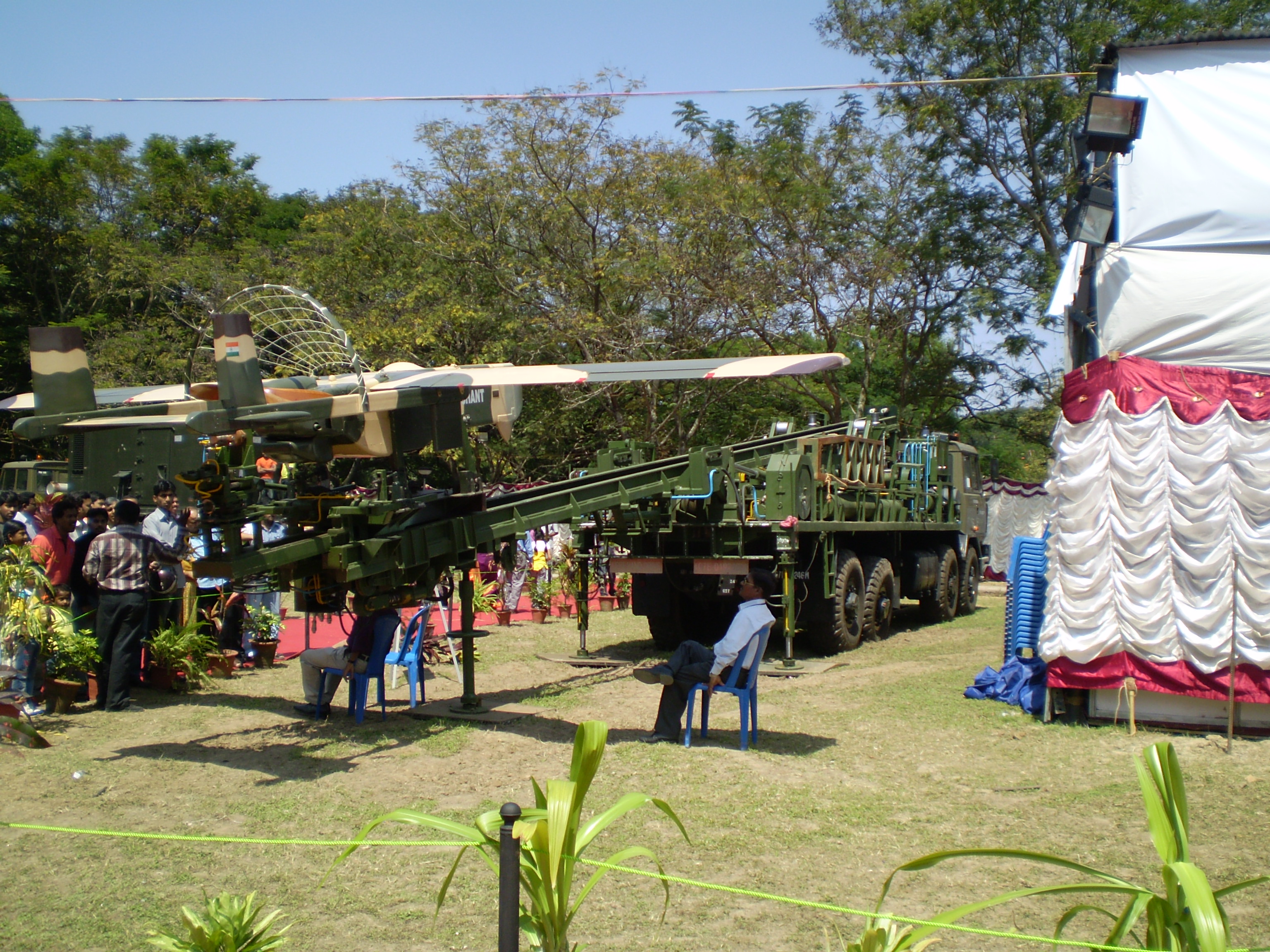
Similarly, the Indian army initially had obtained Searcher Mk Is and IIs, which could operate at altitudes of 15,000 feet, for use along the border with Pakistan. These systems, however, have limited endurance and performed suboptimally at high altitudes, leading the army to instead adopt the Heron. More specifically, in the case of Jammu and Kashmir, UAVs featuring electronic sensors, on-board cameras, and rechargeable batteries are sought since they provide excellent inputs on intrusions and cease-fire violations along Jammu and Kashmir’s Line of Control and the International Border. Although not confirmed, given the classified nature of the subject as it pertains to national security, there is a reported plan “to progressively induct drones right down to the battalion-level [by 2020],” with the army “already establishing new UAV bases from Nagrota and Manasbal in Jammu and Kashmir to Kumbhigram and Lilabari in the northeast.”14

As far as coastal security is concerned, India could broadly use UAVs for law enforcement, anti-smuggling, coastline monitoring and border surveillance, and early warning in defense of vital installations including nuclear sites, power generation centers, major grid installations, dams, reservoirs, and airports. A good option exclusively for electronic reconnaissance is the unarmed and unmanned high-altitude long-endurance (HALE) class of surveillance aircraft. For the purposes of long-range offshore requirements and missions, the Indian navy reportedly employs a squadron of Searcher Mk II and Heron UAVs in the coastal city of Porbandar in the western Indian state of Gujarat, and in the major port city of Kochi on the southwest coast of the southern state of Kerala. A third UAV squadron is at Uchipuli in the southern state of Tamil Nadu. While these UAVs are land-based, they possess the capability to undertake maritime surveillance out to 200 nautical miles. Two additional squadrons are reportedly planned for the southeastern coast and the Andaman and Nicobar Islands. Further, the Eastern Naval Command of the Indian navy has commissioned a third UAV squadron to improve its ability to monitor ship movements, particularly in the Gulf of Mannar, Palk Strait, and the Palk Bay.15

Constraints

Currently, all UAV-related flying is being done with permission from the Directorate General of Civil Aviation (DGCA) and the Ministry of Defence, since all official UAV flights are undertaken strictly by the military and by government agencies. In a 2014 public notice on the civilian use of UAVs, the directorate acknowledged that drones have the “potential for a large number of civil applications.” The directorate went on to note, however, that the use of these systems presents a grave security threat given that urban Indian airspace is highly congested. As a result of insufficient regulations and standards, as well as the relative immaturity of the technology, use of civilian UAVs could result in air collisions and accidents.16 For this reason, “civil operations of UAS require approval from the Air Navigation Service provider, defence, Ministry of Home Affairs, and other concerned security agencies, besides the DGCA.”17

More specifically, the Unmanned Systems Association of India (USAI) is “dedicated towards all the activities and regulations pertaining to the unmanned systems industry in India.”18 Manufacturing of UAVs is licensable as per the notified Defense Products List. In addition, Defence Minister Manohar Parrikar, while replying to a question in the Lok Sabha (lower house of the Indian Parliament), stated that the DGCA will not permit the launch of UAVs, even for civil applications, by any nongovernment agency, organization, or individual in Indian civilian airspace for any purpose whatsoever until it formulates regulations for their certification and operation.19 For this reason the Indian UAV industry has been “calling for a centralized body to draft regulations and set standards for UAV systems.”20

Conclusion

South Asia’s fractured and bitter historical legacy renders it one of the least integrated regions in the world, with a pronounced “security-insecurity paradox.”21 In particular, India faces an array of regional challenges. Non-state actors and terrorist groups are thriving given the advantages of mountainous, inhospitable terrain and areas of thick foliage, coupled with the porous borders of a pliant state. UAV technology has proved to be an extremely beneficial tool for providing surveillance and electronic intelligence gathering capabilities to pierce through the obstacles of complex terrain. At present, India has employed unarmed drones within its territorial jurisdiction, but the military’s broader thinking on this subject remains hard to catalog. However, as the regional security situation either improves or takes a turn for the worse, the Indian military’s doctrinal thinking and strategy on the subject will likewise evolve.22 What should remain unquestionable is that any attempt or action – be it by a nation-state or a non-state actor – to violate Indian airspace, land boundaries, or territorial waters with a UAV will be considered a violation of the nation’s territorial sovereignty and shall be responded to accordingly after a protracted investigation.

stealth-drones-image
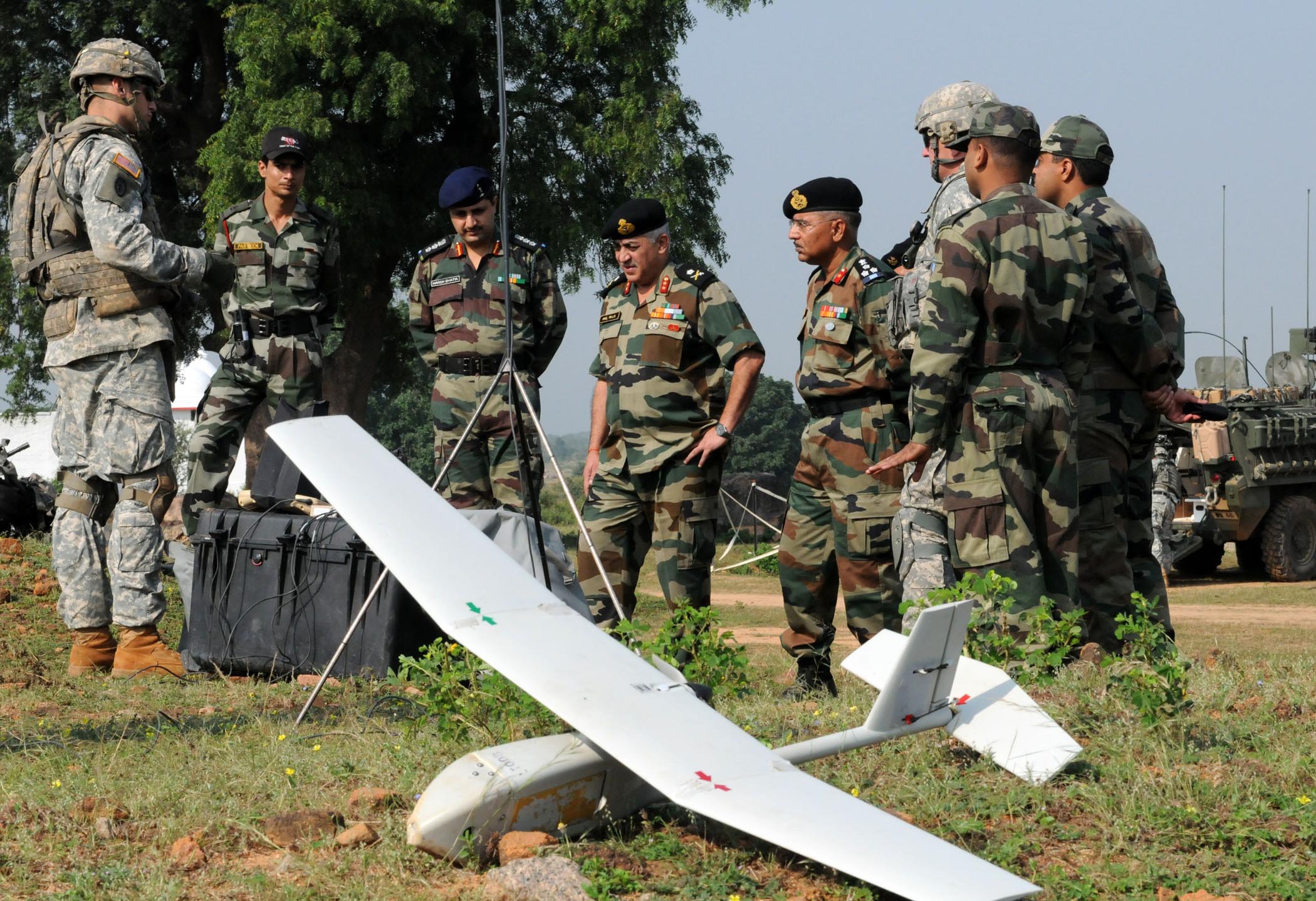
The utility of unmanned systems, the latent potential and benefits of which are not yet fully understood, need to be gauged periodically. Given the complexities of unconventional, subconventional, counterinsurgency, and asymmetric warfare, it is time to steer an informed debate in a direction wherein military technologies are viewed as enablers and enhancers that minimize existential threats to peace and to the security of both citizens and nation-states. It is paradoxical that we live in a world where attackers who incite violence and terror are hard to identify and trace – thereby challenging cogent response options. Unarmed UAVs provide a new and compelling spin to the larger debate on deterrence by denial and deterrence signaling, as they offer decisive headway vis-à-vis aerial surveillance and reconnaissance of land and coastal borders. Most significantly, UAV-provided intelligence leads to proactive, anticipatory action by states to thwart imminent terrorist or insurgent attacks and safeguard the nation.

Disclaimer: The arguments presented in this paper are the personal views of the author in her personal capacity and do not, in any way, reflect the views of the Centre for Land Warfare Studies, the Indian army, the Ministry of Defence, and/or the government of India.

Response: A Perspective on Pakistan

Dr. Daniel Markey

Dr. Chansoria’s assessment stresses that although India’s currently deployed drones are limited in number and capability, India’s regional security challenges; difficult border terrain; and anticipated defense purchases, research, and development efforts all indicate that the country is likely to field a variety of substantially upgraded drones over the next five to ten years.

Pakistan is unlikely to perceive India’s drone program as surprising. That said, Pakistani leaders are likely to find it threatening in three main ways.

First, Pakistan’s military perceives itself in a technological race with India, and although Indian drones do not yet threaten any decisive advantage on the battlefield, Pakistan will be concerned about their long-term potential. As in other aspects of its military competition with India (combat aircraft, nuclear and missile programs), Pakistan will attempt – as much as possible – to outdo or at least keep pace with India. To compensate for gaps in its indigenous development of drone technologies, Pakistan has turned to outside suppliers (including Italy and the United States, but especially China, as already appears to be the case with Pakistan’s armed Burraq UAV).23

Second, to the extent that India’s drone investments begin to provide more capable border surveillance along its land and sea borders, Pakistan will perceive this as a challenge in two respects. In conventional terms, drones could offer India early warning of Pakistani military moves, making a surprise Kargil-like operation even less viable while also exposing vulnerabilities in Pakistan’s own defenses. With respect to Pakistan’s longstanding use of militant proxy forces to attack Indian targets, sophisticated drones (especially if armed) should enable Indian forces to more effectively shut down cross-border infiltration, forcing Pakistan to adjust its tactics over the medium-to-long term.

Third, a major improvement in Indian drone capabilities could enable minor offensive strikes inside Pakistan. But given India’s current technological limitations and Pakistan’s existing air defense systems, this development is unlikely to be a source of significant Pakistani anxiety in the near future.

India’s expanding drone program is not likely to be an immediate or top Pakistani concern, at least when compared to other Indian military capabilities. Even so, it will undoubtedly encourage Pakistan to continue its own investment in similar technologies and countermeasures.

From an American perspective, if improved Indian drones are mainly put to the purpose of border surveillance in ways that reduce the potential for cross-border terrorist attacks, they may initially represent a welcome, stabilizing technology in the short- to medium-term. That said, if the underlying hostility between India and Pakistan persists (as is likely), Pakistan has historically shown a willingness to pursue risky countermeasures to Indian military superiority. Drones thus represent a new opportunity for arms racing, and perhaps, for new areas of conflict with the potential to escalate into more military crises and war.

Dr. Monika Chansoria is a senior fellow at the Centre for Land Warfare Studies, New Delhi, and spoke on this subject at the Meeting of Experts on Lethal Autonomous Weapons Systems (LAWS) in April 2015 at the United Nations office in Geneva.

Dr. Daniel Markey is an adjunct senior fellow for India, Pakistan, and South Asia at the Council on Foreign Relations and a senior research professor at Johns Hopkins University’s School of Advanced International Studies.

  1. Departments of Internal Security, States, Home, Jammu and Kashmir Affairs and Border Management, Annual Report 2014-15, Ministry of Home Affairs, Government of India.
  2. Major General P.K. Chakravorty (Ret.), “Unmanned Aerial Vehicles (UAVs) Indian Perspective,” India Strategic (February 2012), http://www.indiastrategic.in/topstories1369_Unmanned_Aerial_Vehicle.htm.
  3. Alan Taylor, “Ten Years Since the 2004 Indian Ocean Tsunami,” The Atlantic (December 26, 2014), http://www.theatlantic.com/photo/2014/12/ten-years-since-the-2004-indian-ocean-tsunami/100878/.
  4. “Government clears proposal for buying 15 UAVs from Israel,” Press Trust of India, December 29, 2013; and Tova Dvorin, “India to Buy 15 Drones from Israel,” Arutz Sheva, December 30, 2013.
  5. As reported during a conference on “Unmanned Vehicles India 2013” by the Indian Military Review (IMR) Media Group, November 25-26, 2013, New Delhi.
  6. The Actual Ground Position Line (AGPL) is a 110-kilometer-long de facto border running between India and Pakistan, specifically along the Saltoro Ridge in the Siachen Glacier sector. This line is distinct from the Line of Control, which is delimited.
  7. For more details, see “Army to buy 49 mini unmanned aerial vehicles for J-K,” The Economic Times, October 15, 2013.
  8. Rajat Pandit, “India lines up Israeli drones in race with Pak,” The Times of India, March 26, 2010.
  9. Devesh K. Pandey, “Rustum2 UAV will be ready in a year: DRDO,” The Hindu, December 24, 2014, http://www.thehindu.com/sci-tech/technology/rustum2-uav-will-be-ready-in-a-year-drdo/article6722384.ece.
  10. Hemant Kumar Rout, “DRDO Conducts Maiden Test Flight of Panchi UAV,” The New Indian Express, December 25, 2014, http://www.newindianexpress.com/nation/DRDO-Conducts-Maiden-Test-Flight-of-Panchi-UAV/2014/12/25/article2587210.ece.
  11. Rakhi Chakrabarty, “More UAVs watching Bastar 24×7 ahead of polls,” The Times of India, November 2, 2013, http://timesofindia.indiatimes.com/assembly-elections-2013/chhattisgarh-assembly-elections/More-UAVs-watching-Bastar-24×7-ahead-of-polls/articleshow/25079452.cms.
  12. Neha Sethi, “Drones scan flood-hit Uttarakhand,” LiveMint.com, June 24, 2013, http://www.livemint.com/Politics/ZDib5YWR1G2Mcuth1kbwyO/Drones-scan-floodhit-Uttarakhand.html.
  13. Rajat Pandit, “Indian armed forces building deadly drone arsenal, also want combat UAVs,” The Times of India, February 5, 2013.
  14. Ibid.
  15. Between India and Sri Lanka lies a 30-kilometer-long chain of limestone islands, covered with sand, called Adam’s Bridge in English and Ātham Pālam in Tamil. The Gulf of Mannar lies between the southeastern tip of India and the northwestern coast of Sri Lanka. To the northeast of Adam’s Bridge is the Palk Bay, which leads to the Palk Strait; also see a related report, “Israel Sells Heron UAVs to India, Sets Record,” Defense Industry Daily, May 5, 2015, http://www.defenseindustrydaily.com/israel-sells-heron-uavs-to-india-01476/.
  16. Office of the Director General of Civil Aviation, “Use of Unmanned Aerial Vehicle (UAV)/Unmanned Aircraft Systems (UAS) for Civil Applications,” Public Notice, Government of India, October 7, 2014.
  17. Ibid.
  18. Unmanned Systems Association of India, “UAV Regulations in India – A Pre-requisite,” http://www.usai.in/regulations.html.
  19. Indian Defense Minister Manohar Parrikar, “Statement to the Lok Sabha,” as cited in Press Trust of India (Lok Sabha, New Delhi, December 2014).
  20. Unmanned Systems Association of India, “UAV Regulations in India – A Pre-requisite.”
  21. Monika Chansoria, “Peace needs political will,” The Sunday Guardian, July 20, 2014, http://www.sunday-guardian.com/analysis/peace-needs-political-will.
  22. Ministry of Defence, Annual Report 2014-15, Government of India, http://mod.nic.in/writereaddata/AR1415.pdf.
  23. See Usman Ansari, “Pakistan Surprises Many With First Use of Armed Drone,” Defense News, September 10, 2015, http://www.defensenews.com/story/defense/air-space/strike/2015/09/08/pakistan-surprises-many-first-use-armed-drone/71881768/.

Nishant UAV: Image by Kaushal mehta via commons.wikimedia.org

US Army 53500 Strykehorse Soldiers show off UAV capabilities: Image by Sgt. 1st Class Rodney Jackson, 18th Medical Command Public Affairs, U.S. Army via commons.wikimedia.org